Before any building foundation or road base is constructed on any grade, before any fiber optic, electric, oil, gas, water, or sewer line can be laid, engineers must first consider slope stability.
Despite its reputation as a relatively flat plains state, even North Dakota’s more gentle slopes are often comprised of weak, clay-rich sediments that cause costly impacts to infrastructure where they fail. Large or small, fast or slow, landslides have the potential to snap fiber optic and electric cables, break water, sewage, oil and gas pipelines, or undermine building foundations, roads, and railways.
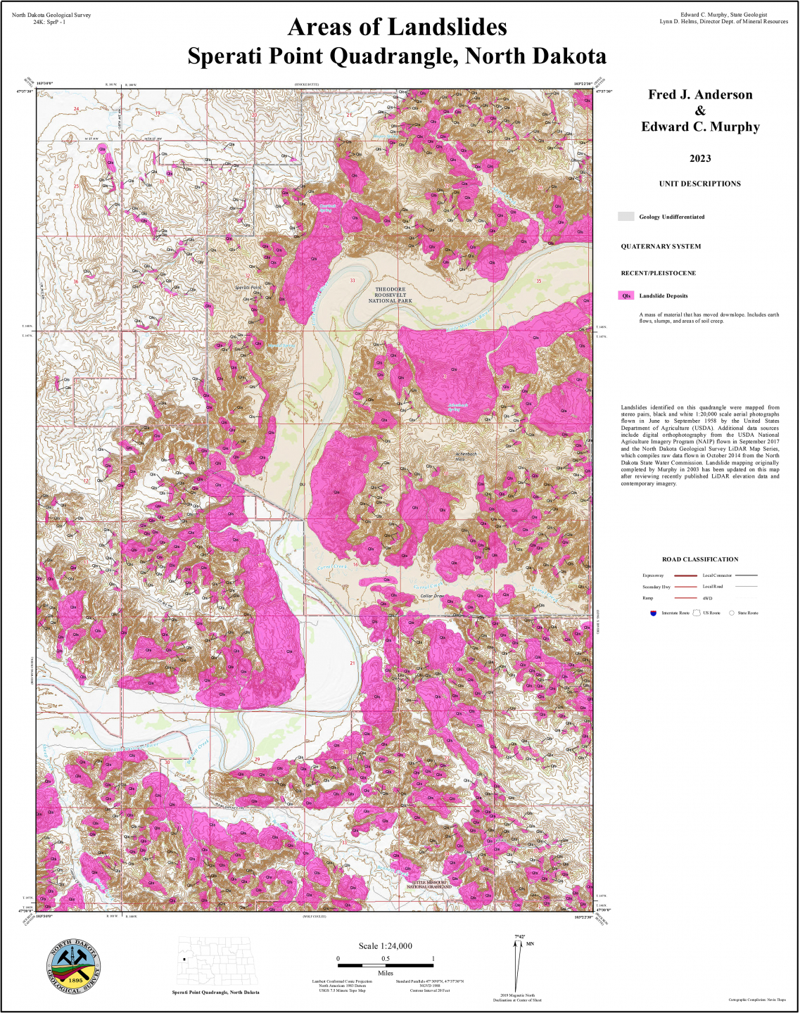
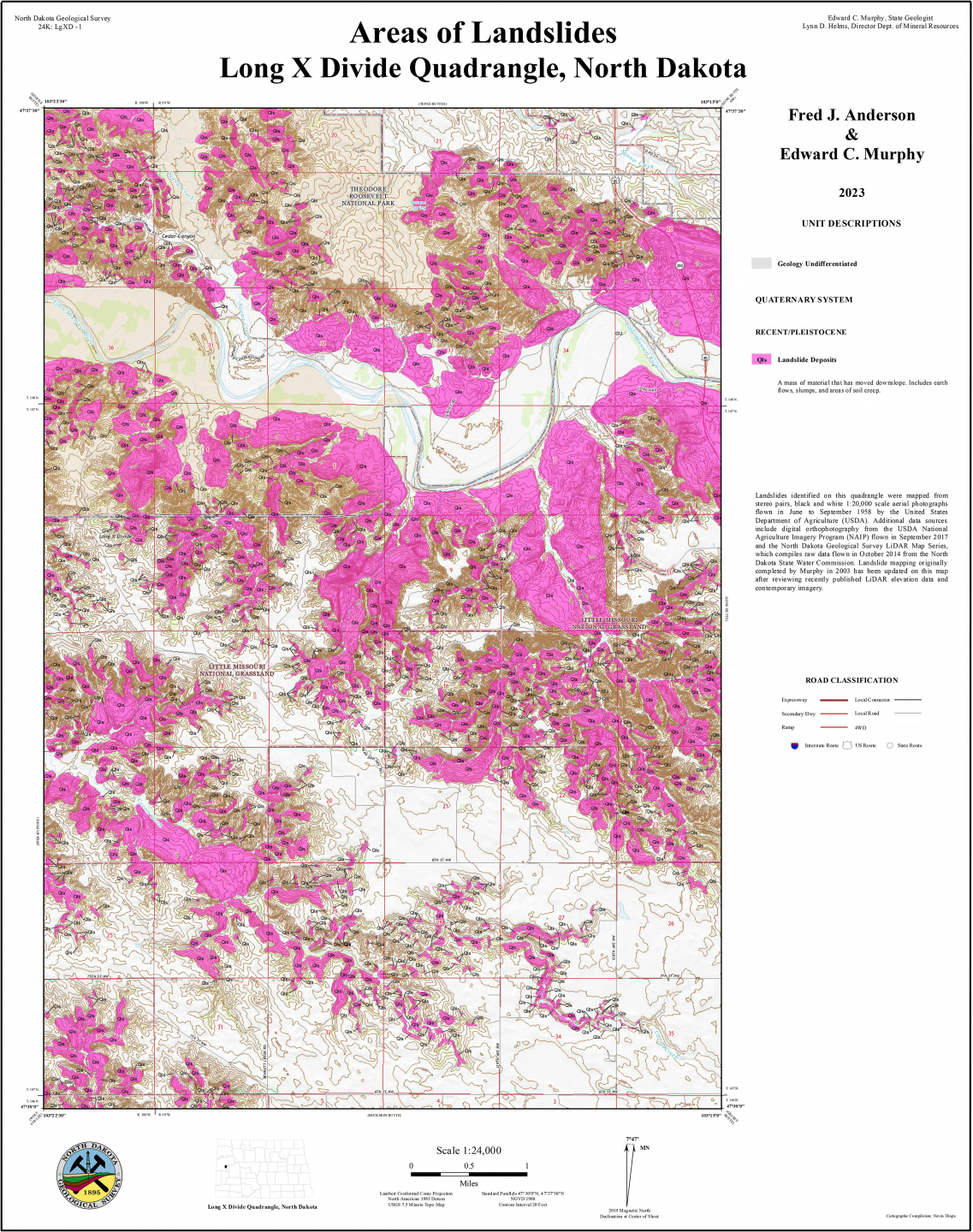
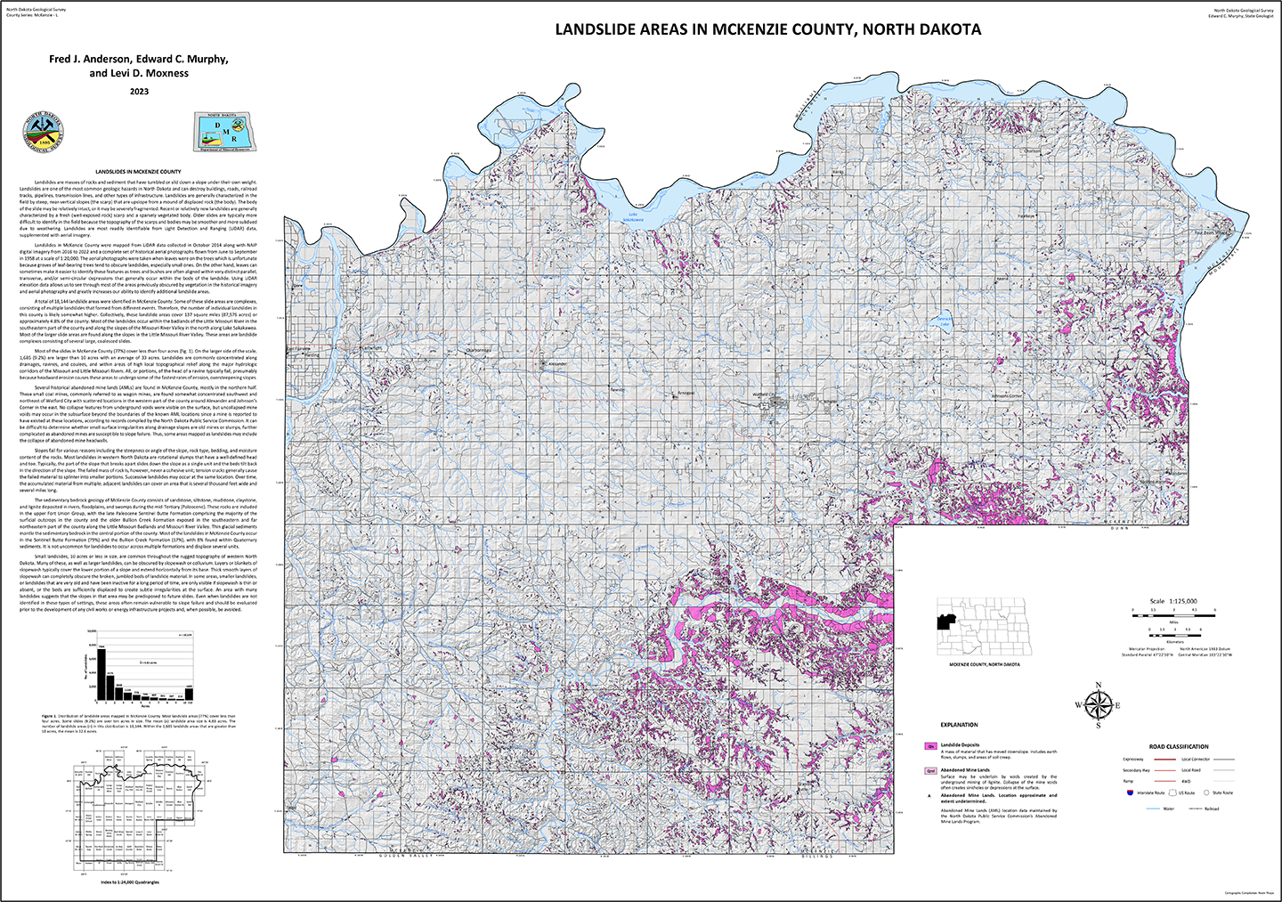
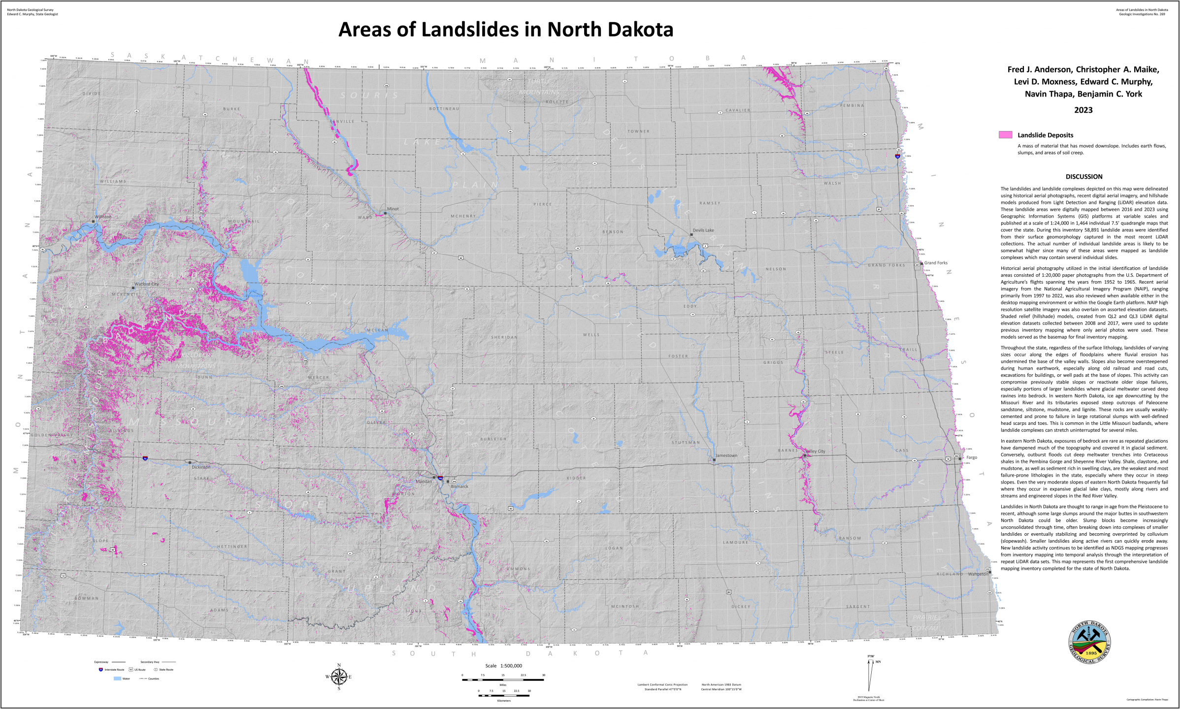
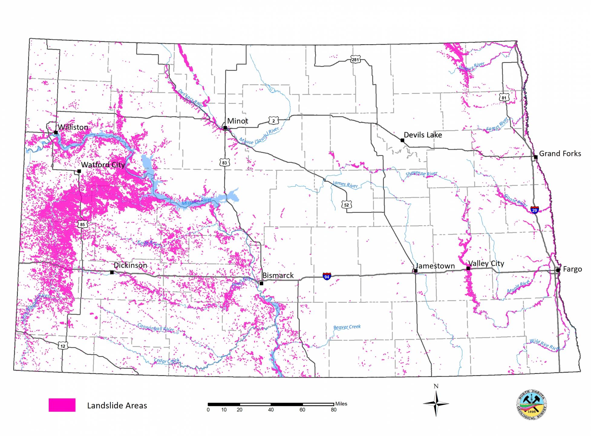
The North Dakota Geological Survey (NDGS) documents the settings in which these slope failures have occurred across the state through its landslide mapping program. Recent Geo News articles have documented the progress of the program, including the dramatic advances in landslide identification via LiDAR (Light Detection and Ranging) and digital aerial photography over the nearly 20 years NDGS geologists have been mapping landslides.
- North Dakota Leads the Nation in Landslide Inventory Mapping
- Landslides Through Time - Active and Dormant Landslides in Eastern North Dakota
- Identifying Active Landslides - Repeat LiDAR coverages allow remote sensing of slope movement
- The First Statewide Landslide Dataset
- River Road Rubble
- Undermined Ground
- Twenty Thousand Slides and Counting
- Landslides in North Dakota
- Ice Jams, Landslides and the Northern Pacific Railway Bridge at Bismarck
To date, the NDGS maintains an inventory of over 80,000 slope failures within North Dakota, a number that will continue to grow as older maps are updated using the latest digital imagery.