[ ]
]
[]

William Keating, a geologist attached to the U.S government's first expedition to the Red River Valley in 1823, provided the earliest geological report of eastern North Dakota. Among his observations,
Keating wrote: "The flatness of the surface that almost uniformly prevails throughout the Valley may be regarded as a defect in its character that cannot be easily remedied." Certainly, it could be argued
whether the flatness is, in fact, a "defect," but you have to admit that it is a characteristic that would be hard to remedy!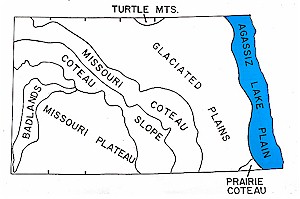 Exceptionally flat plains, like the Red River Valley, are found today in places that were once flooded by lakes of glacial meltwater. Sediment that was deposited from the lake water formed the flat lake floors that geologists refer to as "glacial lake plains." In North Dakota, these include the glacial Lake Souris plain in McHenry and Bottineau counties, the glacial Lake Dakota plain in Dickey and Sargent counties, the glacial Lake McKenzie plain in Burleigh County, and many smaller lake plains. By far the largest of these was glacial Lake Agassiz, once the largest proglacial lake in North America. 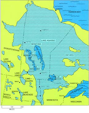 Approximate total extent of glacial Lake Agassiz. At no time did a single lake flood the entire area shown on this map. Rather, during the time the southern part of the area in North Dakota and Minnesota was flooded, beginning about 11,700 years ago, the northern regions were still covered by glacial ice. By the time the northern areas in northern Manitoba were flooded, as recently as 7,500 years ago, much of the southern portion of the lake plain had already drained. Even so, the entire indicated area was at some time submerged beneath the water of Lake Agassiz. Throughout most of the area, little lake sediment was deposited (the thickest lake deposits are found along the North Dakota-Minnesota border), but rather, the lake plain is mainly a wave-washed plain. The map also shows the locations of several of the smaller glacial lakes that existed at various times. These lakes were not all contemporaneous with one another, or with Lake Agassiz. Many of them date to the time prior to the formation of Lake Agassiz, earlier than 12,000 years ago. 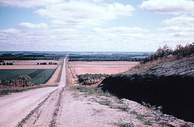 A view of the Lake Agassiz plain from the Pembina Escarpment looking east toward Mountain, North Dakota (Photo by J. Bluemle). 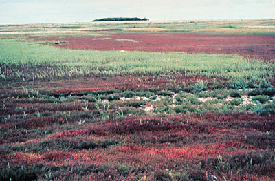 Halophytes (Salicornia ruba) growing in a salty open area near Grand Forks (photo by John Bluemle). 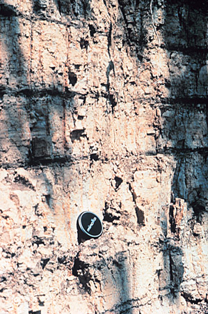 Banded Lake Agassiz sediments near Mayville. Black layers were deposited during winters, thicker, light-colored layers during the summer (photo by John Bluemle). I'll give the briefest of possible summaries of the history of glacial Lake Agassiz: The history of Lake Agassiz in North Dakota covers approximately 2,700 years, from 11,700 years ago until 9,000 years ago. The lake began to form in the Red River Valley when the glacier retreated north of the drainage divide between the Hudson Bay and Mississippi River drainage basins; this is near Browns Valley, Minnesota. North-draining rivers were blocked on the north by the ice sheet. The lake that formed ahead of the retreating glacier was small at first and overflowed southward into the Minnesota River Valley. As the glacier margin receded northward, the lake expanded, flooding the Red River Valley. By about 11,500 years ago, the North Dakota shoreline was lined by an open forest of spruce and deciduous trees mixed with sagebrush-dominated openings. Wooly mammoths roamed the shore. Nomadic bands of humans hunted the mammoths and other game - perhaps they were able to catch fish from the lake. Between about 11,200 and 9,900 years ago, after the glacier margin had receded north of Thunder Bay, Ontario, the lake level dropped in a series of still stands as successively lower outlets to Lake Superior were opened. During this time, the exposed parts of the previously flooded lake floor were covered by spruce and marsh. The lake probably completely drained from North Dakota by 9,900 years ago, but between 9,900 and 9,500 years ago, the glacier readvanced in Canada, blocking the eastern outlets to Lake Superior. Lake Agassiz flooded the Red River Valley again, draining southward into the Minnesota River. By 9,000 years ago, after the glacier had again receded, Lake Agassiz retreated from North Dakota for the last time. The Red River Valley takes on a whole new dimension when viewed from the air. It is exceptionally flat, of course, but it is also marked by oxbows, grooves, spring pits, differential compaction ridges, deltas, and other features. When viewed from a low-flying airplane, the central part of the Red River Valley appears terribly scratched. These scratches, or grooves, are up to six miles long, generally 3 to 10 feet deep, and up to 100 feet wide. The grooves were made by icebergs as they were blown over the surface of the lake during spring breakup. The bottoms of the icebergs dragged in the soft lake sediment, forming the grooves. The grooves are almost imperceptible from the ground, but are reflected in "beaded shelterbelts," which consist of alternating tall and short trees whose growth characteristics are controlled by soil fertility differences between the grooves and the higher areas between the grooves. In parts of Walsh and Grand Forks counties, irregular depressions up to a mile wide and 15 feet deep can be seen. These are spring pits, where salty water is seeping to the surface and slowly removing, or sapping, surface sediments as it flows away. The salty water comes from buried sandstone formations. 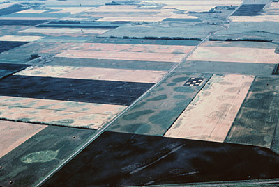 Aerial view of the Red River Valley south of Grand Forks, North Dakota. (Photo by J. Bluemle) 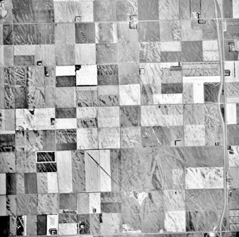 Air photo of the Lake Agassiz plain in Pembina County, about 8 miles south and 2.5 miles west of the town of Pembina, North Dakota. The array of ice-drag markings in this area is striking and seems to indicate plowing by ice in several different directions. 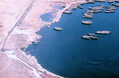 Kelly’s Slough in Grand Forks County. (Photo by J. Bluemle) 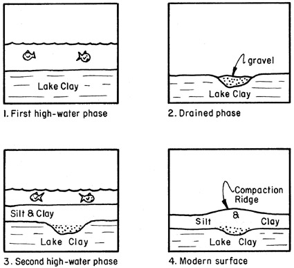 Steps in the formation of a differential compaction ridge. When the early lake flooded the area (1), silt and clay were deposited on the lake floor. When the lake drained, streams flowed across the former lake floor, resulting in valleys in which gravel and sand were deposited (2). The lake flooded the area once again, and another layer of lake sediment was deposited over everything, including the gravel-filled valleys (3). Eventually, when the lake drained for the last time, the sediments dried and the clay-rich lake sediments, which contained large amounts of water, settled substantially. However, the gravel in the now-covered valleys settled only slightly, if at all and, as a result, the former stream valleys were left standing as differential compaction ridges (4). The exceptionally level and open plain of the Red River Valley that Keating found so remarkable gave rise to new large-scale farming methods of the bonanza farms. Bonanza farms were born of the national financial crisis of 1873, when many Northern Pacific Railroad bond holders exchanged their bonds for large tracts of land. As some farms failed, successful farmers were able to acquire even more land, in some cases amassing huge parcels exceeding 40,000 acres in size. These were the bonanza farms, unique to the Red River Valley and especially Cass County. Because of their size, new farming techniques were developed that required hundreds of men and horses and dozens of machines.  |