[ ]
]
[]

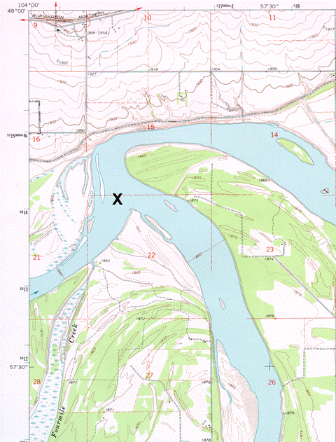
The area featured in X Marks the Spot #8 was well known to the members of the Lewis and Clark Expedition, many of whom were moved to comment in their journals on its beauty.
Meriwether Lewis had the following to say about this remote corner of North Dakota which, visually at least, has changed little since the Corps of Discovery arrived there 200 years ago.
(The names of the rivers have been removed for reasons that will become clear below.)
"I ascended the hills from whence I had a most pleasing view of the country, particularly the wide and fertile vallies formed by the ... and ... rivers,
which occasionally unmasked by the wood on their borders disclose their meanderings for many miles in their passage through these delightful tracts of country." Meriwether Lewis, April 25, 1805
When you have identified the area on the map, submit your name, mailing address, phone number or e-mail address, and responses to the following questions:
(1) Which two rivers come together at the confluence marked by the X?
(2) Extra credit: From what formation are the rocks after which the smaller of the two rivers is named derived? (No prize for the correct answer, but you will receive an honorable mention in the next Newsletter).