[ ]
]
[]

|
No, this is not a sequel to Frank Herbert's classic science fiction novel Dune. However, some people do have a hard time taking me seriously when I start telling them about North Dakota's
sand dunes; perhaps they think I'm talking fiction. You find dunes in the desert, right? Yes, you may, but you also find them in North Dakota. North Dakota has several areas of fairly
good-sized sand dunes. None remotely like the ones described by Herbert on the planet Dune, or even the more earthly dunes found near Alamosa, Colorado in Great Sand Dunes National Monument,
or the widespread dunes in the sand hills of western Nebraska. Even so, our dunes are interesting features and a pleasant place to spend an afternoon roaming around (but best on a clear summer
day; dunes are about the easiest place I know of to get lost in during a snowstorm or on a foggy day). The dunes in the Sheyenne National Grasslands are particularly interesting for their extensive
areas of native prairie. All of the larger areas of dunes in North Dakota are found in areas where sand was originally deposited by glacial-related processes. Most of the dunes in North Dakota probably formed between about 8,500 and 5,500 years ago. They formed during a period of time that geologists refer to as the "Altithermal Interval." The Altithermal Interval ("Altithermal" = maximum temperature) was the warmest and driest time since the end of the Ice Age, a time when most of the world experienced mean annual temperatures higher than those today (one of the numerous episodes of "global warming" we’ve experienced over the millennia). During much of the long, warm and dry Altithermal Interval, conditions were similar to those during the 1930's in North Dakota, when the cover of vegetation became so sparse it was no longer effective in controlling wind erosion. Many North Dakotans still remember the terrible dust storms over the plains during the so-called "dirty thirties," and of course the drought of the late 1980's and early 1990's is still fresh in most people's minds. 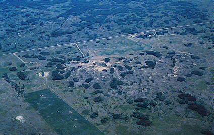 Dunes near Denbigh, McHenry County (Photo by J. Bluemle). 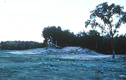 Dunes at Denbigh, McHenry County (Photo by J. Bluemle). In places where sediment-laden, Ice-Age rivers flowed into glacier-dammed lakes like Lake Agassiz and Lake Souris about 10,000 years ago, they deposited large amounts of well-sorted sand. The sand built up fans at the mouths of the rivers. The heavy, sediment-laden river water stayed near the bottom of the lake and spread out over a broad area. The coarser materials had either been deposited farther upstream, on the river floor itself, or they were deposited very close to the river mouth; only the finer sand and coarse silt made it into the lake. It was this well-sorted sand that was later blown into dunes. Many of our North Dakota dunes are from 50 to 80 feet high and a few are nearly 100 feet high. It's hard to visualize by standing on the top of a dune (you need to be higher, in an airplane), but many of the dunes have a strong northwest-southeast linearity, parallel to the direction the wind was blowing when it built them. These are known as longitudinal dunes. A few of our dunes are crescent shaped with their convex side pointing toward the northwest or nearly north (upwind), and their ends pointing southeastward (downwind). In North Dakota, the crescent-shaped dunes are not as large as the longitudinal dunes. Geologists generally refer to them as barchan dunes (pronounced bar-con; the word is Turkish and means "sand hill"). They are also known as horseshoe dunes or parabolic dunes. 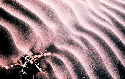 Wind blown ripples southwest of Walcott, North Dakota (Photo by J. Bluemle). 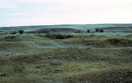 Dunes nortwest of Fort Yates in the Porcupine Creek Valley. 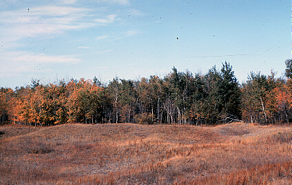 Dunes and aspen near Hamar, Eddy County, North Dakota (Photo by J. Bluemle). |