 |
X
Marks the Spot: #4 |
|
X
Marks the Spot: #4 |
By
Mark A. Gonzalez |
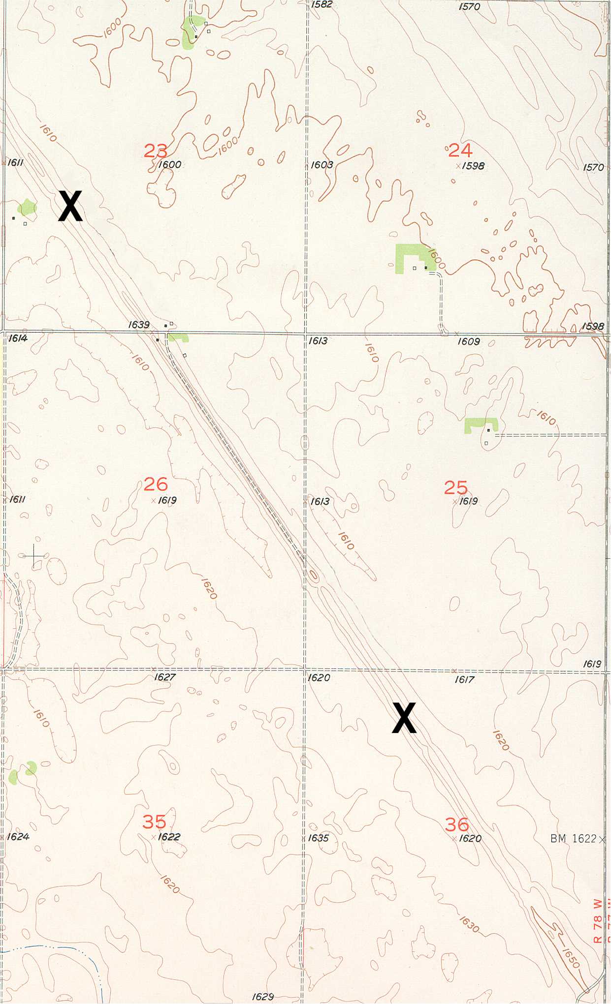
| The contest for
this issue is a prominent and large landform that extends for 17 miles across
central North Dakota. Although the landform is visible from the ground to
the trained eye, it is most noticeable from a bird’s eye vantage.
The X marks a small segment of this 17-mile-long landform. The landform
is typically 250 feet wide at its base and 50 to 70 feet high. When you
have identified the landform, submit your name, mailing address, phone number
or e-mail address, and responses to these questions. |
| (1) What is the “formal,” place name of the landform marked by the X's? |
| (2) What is the geologic, or geomorphic, name for this type of landform? |
| (3) For extra credit: Explain how this type of landform is created. |
| Note: hypotheses vary and specific details are widely debated. Any reasonable explanation is acceptable. |
| Those individuals who submit correct responses will be eligible for prizes. Two names will be drawn at random by the staff of the NDGS. One selected respondent will receive a copy of The Face of North Dakota, and another will receive a Geologic Map of North Dakota. |
| Please submit responses by 15 Feburary, 2003. Winners of our drawing and the correct answers will appear on our web site shortly thereafter and in the next issue of the NDGS Newsletter. |
![]()
Copyright
2002 North Dakota Geological Survey
Last modified:
09/26/2005