 |
NORTH
DAKOTA NOTES NO. 15 |
NORTH DAKOTA'S MOUNTAINOUS AREAS:
THE KILLDEER MOUNTAINS AND THE TURTLE MOUNTAINSby John Bluemle
It is at least somewhat peculiar that the Killdeer Mountains, Turtle Mountains, and several other features in North Dakota are called "mountains;" I suppose the idea is related somewhat to scale. When viewed by a person who has recently traveled over eastern North Dakota, the features certainly are impressive, but I wonder what they might have been named if our settlers had come from Montana or Wyoming.
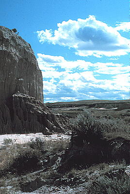
Killdeer Mountains (Photo by J. Bluemle)
Besides the Turtle Mountains and Killdeer Mountains, we have many other places in North Dakota that bear the name "mountain." The town of Mountain in Pembina County was settled by Icelanders in 1873. Mountain is situated on the former shoreline of glacial Lake Agassiz, and the view to the east from there, over the Red River Valley, is impressive. Just north of Mountain, the hilly area along the Pembina River Valley in northeastern North Dakota is sometimes referred to as the "Pembina Mountains," but the term "Pembina Hills" is also commonly used. The steep escarpment is also referred to as the "Pembina Escarpment" or "Manitoba Escarpment."
Other "mountains" in North Dakota include Devils Lake Mountain in southeastern Ramsey County, Blue Mountain in western Nelson County, Lookout Mountain in northeastern Eddy County, and the Prophets Mountains in western Sheridan County. All of these features are ice-thrust hills or complexes of ice-thrust topography that stand as high as a few hundred feet above the surrounding areas (see North Dakota Note #11). Another "mountain" is Tracy Mountain, a large butte in Billings County, near Medora, but we don't have many "mountains" in southwestern North Dakota; the term "butte" is more often used there. We have several hundred other formally named features called "hills" or "buttes" in North Dakota, and a few "points" and "ridges," many of which are at least as impressive as some of our "mountains." In any case, I won't dwell any longer on the vagaries of naming topographic features. The names don't necessarily make much sense and it's not really important anyway; we do manage to communicate, at least if we stay close to home.
This article will deal mainly with the Killdeer and Turtle Mountains, both areas of considerable scenic beauty no matter what you want to call them, and both with interesting geologic stories to be told.
Little Badlands, Stark County, North Dakota (Photo by J. Bluemle).
The Killdeer Mountains
The Killdeer Mountains consist of two large, flat-topped buttes in Dunn County that cover a total area of about 115 square miles and rise about 700 feet above the surrounding plains — as much as 1,000 feet above the Little Missouri River floodplain in the badlands six miles to the north and west. The entire elevated region is about nine miles long and six miles wide. The highest elevation in the area is 3,314 feet, 192 feet lower than the highest point in the state (White Butte). The term "Killdeer" presumably is a translation of a Sioux phrase "Tah-kah-p-kuty" (the place where they kill the deer).
The caprock of the Killdeer Mountains consists of a 300-foot-thick sequence of tufaceous siltstones, sandstones, and carbonates that belong to the Miocene-age Arikaree Formation. One of the most conspicuous, ledge-forming units is found about 150 feet below the caprock. Known as the "burrowed marker unit," it is a sequence of interbedded siltstone, sandstone, with occasional carbonate lenses. The Arikaree Formation is underlain by the Eocene-age Chadron Formation, a sequence of yellow to green sandy mudstone, clayey sandstone, and pebbly sandstone. The tree-covered, grassy, or farmed slopes around the flanks of the Killdeer Mountains are underlain primarily by the Golden Valley Formation, a Paleocene to Eocene age rock unit. The Paleocene Sentinel Butte Formation underlies the Golden Valley Formation beneath the Killdeer Mountains and occurs at the surface in a broad area around the Killdeers.
Killdeer Mountains (Photo by J. Bluemle)
The buttes that make up the Killdeer Mountains are erosional outliers, probably places where large lakes in which sandy and limy sediments and some stream deposits accumulated in middle to late Cenozoic time. Repeated volcanic eruptions in the Rocky Mountains to the west produced large amounts of ash, which blew eastward, fell to the ground, and washed into the lakes, forming tufaceous (meaning they contain volcanic ash) sandstones. About 5 million years ago, long after the lakes were filled, a new erosional cycle began. The relatively hard tuffs and freshwater limestones and sandstones that had been deposited in the Miocene lakes were much more resistant to erosion than were the surrounding sediments. Because of their resistance to erosion, these hard materials remained standing above the surrounding area as the softer Golden Valley and Sentinel Butte sediments were eroded and carried away by streams and rivers to Hudson Bay. The Killdeer Mountains, with their resistant caprock, are the result of that erosion cycle; they are the modern manifestation of an ancient lake bed.
Two sites in the Killdeer Mountains are of particular interest. The Killdeer Battle State Historic Site is located on the southeast edge of the area (Section 34, T146N, R96W). The "Battle of the Killdeer Mountains" took place on July 28, 1864 when General Sully and 3,000 troops used artillery on 6,000 Teton and Yanktonai Sioux in revenge for the uprising of Santee Sioux in southern Minnesota. Sully defeated the Sioux, killing many of them and destroying their camp and equipment.
At the top of the southeast spur of the Killdeer Mountains is Medicine Hole, a "cave" about 10 feet across and 90 feet deep. This was the traditional location for the place where, according to Native Americans living there, all animals and people came out of the earth at the beginning of time. Medicine Hole is located on the Medicine Hole Plateau, in the south half of Section 22 and the north half of Section 27, T146N, R96W. In this one-square-mile area, the Arikaree Formation is especially well exposed.
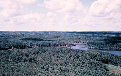
Northerly view of the Killdeer Mountains, 8 1/4 miles northwest of Killdeer, North Dakota (Photo by J. Bluemle).
The Killdeer Mountains support the largest deciduous forest in southwestern North Dakota, except for the forests of the floodplains bordering the major rivers. The Killdeer forest consists largely of aspen and oak, with some ash, elm, birch, and juniper, 06-Aug-2007 buffaloberry. The forest is interesting in that it contains species typically found in more boreal settings, 200 miles or more to the northeast.
Although the Killdeer Mountains were apparently not covered by the continental glaciers, their topography dates largely to the Pleistocene. Remnants of old stream-cut surfaces — pediments — flank the Killdeers. These pediments, which cut across all of the older formations, are capped by about 10 feet of sand and gravel. Old ice wedges can be seen in the gravel in places, testimony to the time when the area was subjected to tundra conditions during one or more of the glacial epochs.
In summary, the Killdeer Mountains are an erosional outlier, preserved because of their resistant caprock of tufaceous sandstone and limestone. Erosion of the area that began in late Pliocene and continued into early Pleistocene time resulted in gravel-covered surfaces (pediments) around the flanks of the Killdeer Mountains. These gravel deposits, which were derived from the sandstone and limestone beds higher up in the Killdeers, are themselves resistant to further erosion and they help to retard the ongoing, modern erosion cycle. The present erosion cycle began when the nearby Little Missouri River was diverted from its northerly route by a glacier so that it flowed, instead, to the east to its modern confluence with the Missouri River. As a result of the diversion, the river began to erode vigorously, carving the badlands through which the Little Missouri River flows today.
The Turtle Mountains
The origin of the name "Turtle Mountains" has never been definitely explained. Between 1810 and 1870, Metis hunters from the Red River followed trails north and south of the feature, to the buffalo herds. When viewed from the south, the mountains appeared to the Metis as a turtle on the horizon with the head pointing westward and the tail to the east. Another account says that the feature was named after an Ojibwa Indian, "Makinak," (turtle) who walked its entire length in one day. The Ojibwa often took their names from things in Nature and the turtle was an important figure in their religious mythology. Other names that have referred to the Turtle Mountains include Makinak Wudjiiw, La Montagne Torchue, Turtle Hill, Beckoning Hills, and the Blue Jewel of the Plain. Still another possible origin for the name might be the painted turtles, which are plentiful in the area today. The only "semi-official" information I could find that referred to the origin of the name was included in the early accounts of government cartographers, who noted that, from a distance, the profile of the plateau resembles the back of a turtle.
Dead-ice moraine of the Turtle Mountains (Photo by J. Bluemle).
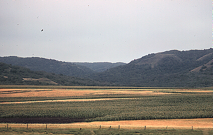
The Turtle Mountains rise about 600 to 800 feet above their surroundings, high enough to receive significantly more precipitation than the surrounding grasslands. As a result of this heavier precipitation, the Turtle Mountains are forested. They cover an area of about a thousand square miles, half in North Dakota, half in Manitoba and this, along with river bottom land and the forested Pembina Hills area to the east, is one of the few wooded areas in the region.
The predominant covering of aspen is interspersed with black poplar, ash, birch, box elder, elm, and bur oak. A large part of the vegetation consists of shrubs like hazel, chokecherry, saskatoon, nanny berry, dogwood, highbush cranberry (Pembina), and pincherry. Fire played an important role in the development of present-day vegetation. Prior to settlement, the Turtle Mountains were periodically swept by fire caused by lightning and by human activity. Plains Indians noticed that a heavy growth of new plants appeared in burned areas. They also knew that forests did not attract bison so they routinely set fire to the wooded areas. Prairie winds then carried the fires for many miles. This practice may represent one of the earlier attempts by man to attract animals by manipulating the environment.
Bouldery slope at Dunseith, North Dakota at the edge of the Turtle Mountains (Photo by J. Bluemle).
Like the Killdeer Mountains, the Turtle Mountains are basically an erosional outlier, a broad area of younger sediments left standing when the surrounding older materials were eroded away. Unlike the Killdeers, however, the Turtle Mountains were glaciated and the landforms that resulted from that glaciation greatly changed the area. Had they not been glaciated, the Turtle Mountains might be more similar to the Killdeer Mountains, although much broader and probably not so prominent a feature.
The Turtle Mountains are underlain by rocks of the Cretaceous Fox Hills and Hell Creek Formations and the Paleocene Cannonball Formation, all covered by a thick layer of glacial sediment. In early Pliocene or late Miocene time (maybe 5 or 6 million years ago), the area that is now the Turtle Mountains was apparently part of a broad plain that sloped to the northeast. Rivers and streams flowed over the plain from the west and southwest, making their way to Hudson Bay. Then, in Pliocene time, maybe 5 million years ago, erosion increased markedly and large amounts of material were removed as deep valleys dissected the plain. It is not really known why this cycle of erosion began. Perhaps the area was uplifted by geologic forces so that streams began to cut into the sediments they had been flowing over, or perhaps the climate changed. As sediment was eroded away, new hills and valleys were shaped and, gradually, as the sediments surrounding the Turtle Mountains were carried away to Hudson Bay, a large mesa was left standing where the Turtle Mountains are today. The reason the outlier developed where it did is not entirely clear. The uppermost bedrock unit on the Turtle Mountains (beneath the covering of glacial sediment) is the Tertiary Cannonball Formation, which is not notably resistant to erosion. It is possible, of course, that some kind of resistant layer was present throughout much of the erosion cycle; perhaps a part of the lower Bullion Creek Formation. It is also possible that additional drilling in the area will eventually penetrate a remnant of some resistant material we have not yet found. If any resistant layer exists, it is deeply buried beneath glacial sediments.
Dead-ice terrainin Wakopa Refuge, Turtle Mountains, North Dakota (Photo by J. Bluemle).
About two million years ago, at the beginning of the Pleistocene Epoch, the climate turned colder and, as snow built up to great depths near Hudson Bay, glaciers formed and flowed southward, out of Canada into North Dakota. As the climate fluctuated, glaciers advanced and receded, flowing over and around the Turtle Mountains several times. Finally, about 25,000 years ago, the Late Wisconsinan glacier flowed southward over the Turtle Mountains.
During Late Wisconsinan time, the most recent major glaciation, the Turtle Mountains were continuously buried under the actively moving glacial ice for about 10,000 years. The movement of the glacial ice over the obstruction formed by the Turtle Mountains caused the ice to become compressed and resulted in shearing within the glacier (see North Dakota Note #14). The shearing of the ice at the edge of the Turtle Mountains caused large volumes of rock and sediment to be incorporated into the ice. As the climate moderated between about 15,000 and 13,000 years ago, the glacier thinned and its margin receded northward. Since the Turtle Mountains rise 600 to 800 feet above the surrounding area, and since ice 200 or 300 feet thick will flow under its own weight, glacial flow continued for awhile on either side of the Turtle Mountains. At the same time, the glacier on top of the Turtle Mountains stagnated, leaving several hundred feet of debris-covered ice covering the surface.
Long Lake, Turtle Mountains, North Dakota (Photo by J. Bluemle).
In areas surrounding the Turtle Mountains, where shearing of material into the glacier had not been as intense, the ice was cleaner, and it simply melted away, although as the glacier continued to move over these lower areas around the edge of the Turtle Mountains, it did deposit a few feet of sediment in places. However, as the debris-covered, stagnant ice over the Turtle Mountains melted, the debris it contained gradually became concentrated at the surface of the ice, resulting in an increasingly thick insulating layer that greatly retarded the rate of melting. Thus, even though the glacier stopped moving and stagnated over the Turtle Mountains about 13,000 years ago, the layer of insulation that built up on top of the stagnant glacial ice kept it from melting for about 3,000 years. It was not until about 10,000 years ago that the last ice on the Turtle Mountains melted.
The covering of glacial sediment on the stagnant glacier on the Turtle Mountains was irregularly distributed and, as a result, the ice there melted unevenly. This uneven melting caused the upper surface of the stagnant ice to become hilly and pitted with irregular depressions. The glacial sediment on and within the ice was saturated with water from the melting ice and it was highly fluid. It slid down the ice slopes as debris flows and filled in the depressions. Thick accumulations of debris in the depressions on the stagnant glacier caused the ice in those places to melt more slowly, whereas newly exposed ice, from which the insulating cover had recently slid, melted more rapidly, resulting in continued reshaping of the surface of the stagnant, sediment-covered glacier.
The environment over the Turtle Mountains gradually stabilized and the lakes flooding the sediment-lined depressions on the stagnant glacier became more temperate. Most of the water in the lakes came from runoff from local precipitation, rather than water from melting glacial ice. Precipitation at the time was much greater than it is today, probably 50 inches or more a year, and the mean annual temperature was a few degrees cooler than it is today.
Fish and clams and other animals and plants thrived in the lakes that developed on top of the sediment-covered glacier on the Turtle Mountains. Surrounding the lakes and streams, the covered glacier was forested by spruce, tamarack, birch, poplar, aquatic mosses, and other vegetation, much like parts of northern Minnesota today. The stagnant-ice environment in the Turtle Mountains about 10,000 years ago was similar, in many ways, to stagnant, sediment-covered parts of certain glaciers in south-central Alaska today.
Eventually, all the stagnant ice over the Turtle Mountains melted, and all of the material on top of the glacier was distributed in its present position, forming the hilly "collapse" topography that is found in the area today. These landforms are sometimes referred to by geologists as "hummocky collapsed glacial topography," or "dead-ice moraine."
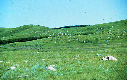
The modern landscape in the Turtle Mountains is marked by hundreds of lakes and ponds, hummocky topography, but with some fairly broad, flat areas that stand above the surrounding rougher land and some flat, lowland areas. Many of the flat areas are old lake plains of silt and clay that were once surrounded by glacial ice ("elevated lake plains"). Other flat areas are covered by stream deposits of gravel and sand.
To summarize -- the Killdeer Mountains and Turtle Mountains are two of the state's most scenic areas. They are erosional outliers, the former retaining its rugged, flat-topped nature characteristic of the buttes of southwestern North Dakota, and the latter reshaped by glaciation. They may rise only about 700 to 800 feet above the surrounding plains, but in that context, surrounded by a sea of grass, they truly do appear mountainous.
ND Notes Main Page
Copyright © 2002 North Dakota Geological Survey
Last modified:
28-Sep-2005